God made Earth and humans made boundaries
India shares its borders with seven other countries. Some of which are friendly and are easy to access and other are not so easy to cross. India borders in the North with Nepal, China and Bhutan. On Western side lays Pakistan. Myanmar and Bangladesh on East province. And Sri Lanka on South separated by sea.
Indo-Pakistan Border

It is an International Border of 3,323 km long. There are 3 points of division.
First is Line of Control (LoC) that divides Kashmir in India from Kashmir in Pakistan. Then is Wagah Border, which separates the Punjab state in India and Punjab Province of Pakistan, in the east. The third is the Zero Point that divides the Indian states of Gujarat and Rajasthan to Sindh province of Pakistan, in the south.
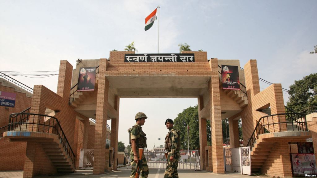
The Wagah Border lies in Atari village of Punjab, India. You can visit the Wagah Border and can see the Wagah Border Ceremony, which is particularly known for the flag ceremony which occurs every day at Border gate during sunset. There the Border Security Force (BSF) conducts the flag ceremony. Samjhauta Express is the linking train that runs from Atari to Lahore in Pakistan.
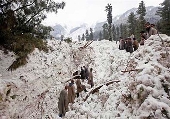
The LoC is considered to be the highest tense border around the world. At the end of the LoC lies the Siachen Glacier which is located in the eastern Karakoram Range in the Himalaya Mountains. It is considered to be the highest battleground on Earth. Both the countries have maintained a permanent military existence at the height of over 6,000 m. Since 2007, India allows limited mountaineering and trekking trip to the area.
Munabao is a village in Rajasthan, India that borders with Khokhrapar in Pakistan. The Thar Express, which is the second linking railway line between India and Pakistan, runs from Munabao to the Zero Point, which is the last railway station in Pakistan. It was built in 2006 which is used for immigration and customs of passengers that travel between India and Pakistan.
India-China Border


India shares 3,380 km with China. The McMahon Line is a boundary between China and India. It is regarded by India as the legal national border, but is disputed by China. Indian nationals can visit China on tourist visa with a limit to 10 – 15 day. Nathu La Pass between Sikkim in India and Southern Tibet has recently reopened for trade between the two countries. This pass is not open for tourists.
India-Nepal Border


It is one of the friendly borders of India. You can easily cross the borders. It shares 1,236 km border with Bihar, Uttar Pradesh and Sikkim. You can easily cross the countries without any visa or passport either by road or by flight. Nepal is quite famous for tourist attraction. It is the land of trekking. Along with that you can enjoy rafting, mountain biking and jungle safari.
India-Bhutan Border
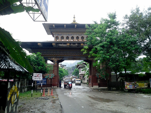

India and Bhutan shares 699 km long border and link up Assam, Arunachal Pradesh, West Bengal and Sikkim. The entry points between these two countries are between Jaigaon in West Bengal, India and Phuntsholing in South West Bhutan. It is one of the friendly cross borders among the international borders of India.
You can easily cross this country. People from India, Bangladesh and Maldives do not need visa for entering. Bhutan is a beautiful destination to visit lying in the Himalayas region. You can visit monasteries, attend their cultural festivals and you can go for trekking or biking as it has marvelous scenic views. Taktsang Monastery is one of the most important sites of Buddhist in the world.
India-Myanmar Border


Also known as India- Burma Border is 1,624 km long border. India shares 4 states with Myanmar, which are Arunachal Pradesh, Nagaland, Mizoram and Manipur. Myanmar is also the part of India- Thailand highway. Moreh is on the India-Myanmar border. Since 2014, permit is necessary for crossing the boundaries.
India-Bangladesh
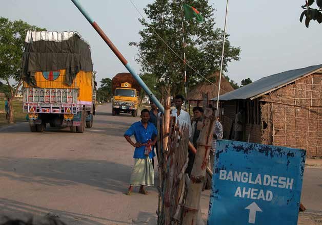

It is an international border that delineates six divisions of Bangladesh and India. It is the fifth longest land border in the world of 4,096-km long. It includes Assam, Tripura, Mizoram, Meghalaya, and West Bengal from India side and Dhaka, Khulna, Rajshahi, Rangpur, Sylhet and Chittagong from Bangladesh division.
The border has created a narrow strip known as “Siliguri Corridor” or “Chicken’s Neck.” The most common way to cross the border is through buses that operate from Kolkata, Siliguri and Agratala. The alternate option is via train, Maitree Express that was suspended for 42 years, but again started in April 2008 between Dhaka- Kolkata.
Bangladesh is rich in archaeological sites, beaches, forest and wildlife. The places to visit are:
- Sundarbans, The 70% of Sundarbans are in Bangladesh and remaining in India. It is UNESCO world heritage site, largest Mangrove forest of the earth.
- Cox’s Bazar is world’s longest uninterrupted natural sandy sea beach
- Martins Island is famous for being only coral island in Bangladesh
- Keokradong peak, which is the highest peak of the country
- Nafa-khum Waterfall is the largest waterfall of Bangladesh that offers rafting
- Lawachara National Park
India-Sri Lanka Border


Sri Lanka and India are separated by sea. It is believed that Adam’s Bridge, also known as Rama’s Bridge, or Rama, is a former land connection between the two countries. The bridge is built between Pamban Island (Rameswaram Island), lies in the coast of Tamil Nadu, India, and Mannar Island, which is in Sri Lanka. The bridge is of 30 km long. Till 1966, ferries were used to connect the railway lines that ended at Thalaimannar in Sri Lanka and Dhanushkodi in India.
You can get visa on arrival easily from India to visit Sri Lanka. This country is rich in heritage and scenic beauty.